


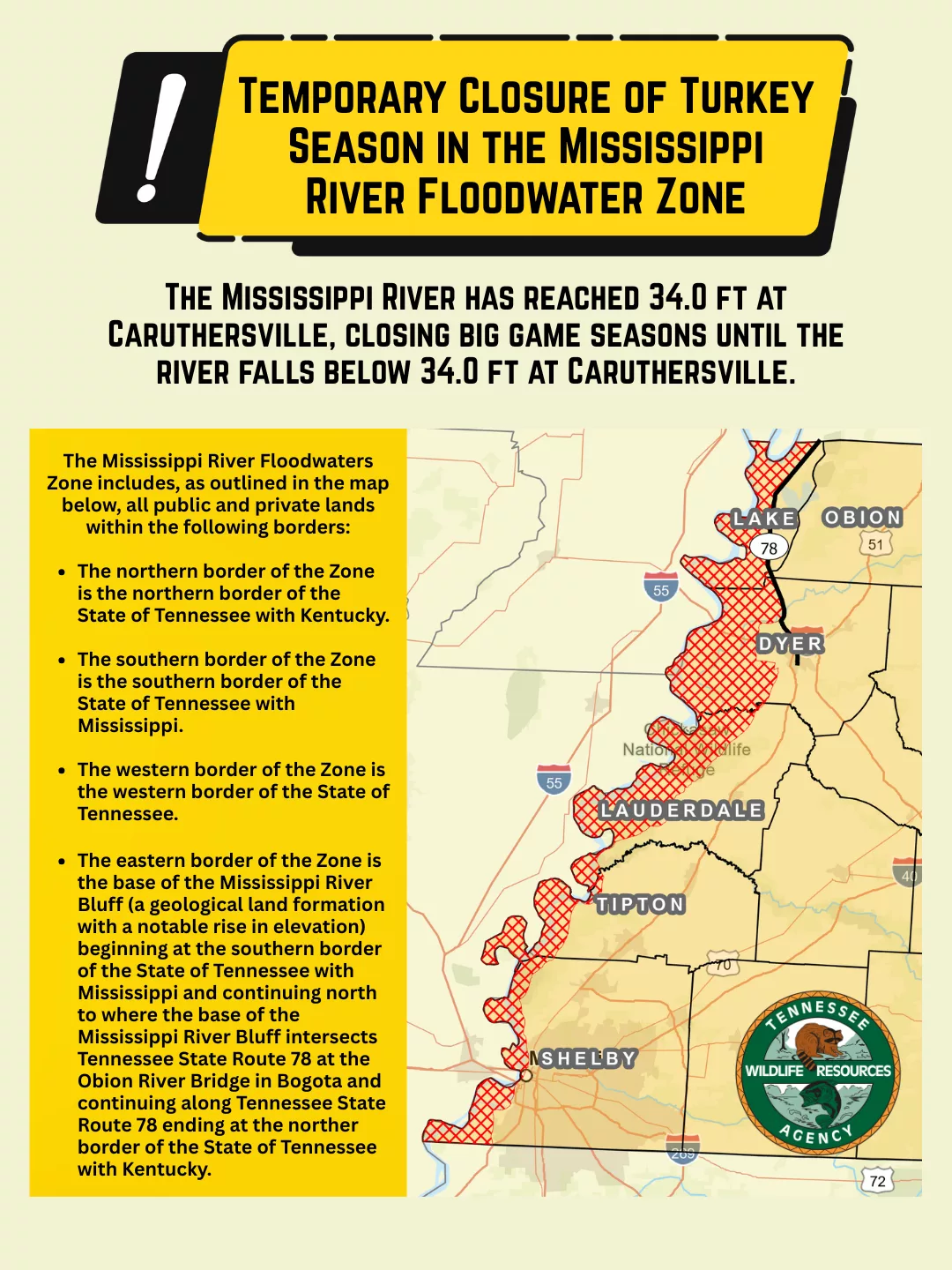
JACKSON — The Mississippi River has reached a stage of thirty-four feet (34.0 ft.) at the Caruthersville gauge (U.S. Army Corps of Engineers gauge at river mile 846.4). As a result, all big game hunting in the Mississippi River Floodwaters Zone will be closed. This closure will remain in effect until the river stage falls below thirty-four feet (34.0 ft.) at the Caruthersville gauge. The closure applies to both private and public lands within the Zone and will impact the spring turkey season.
As outlined in the map below, the Mississippi River Floodwaters Zone (the “Zone”) includes all public and private lands within the following borders: The northern border of the Zone is the north border of the State of Tennessee with Kentucky (Mississippi River Mile 715); The southern border of the Zone is the south border of the State of Tennessee with Mississippi (Mississippi River Mile 905); The Zone’s western border is the State of Tennessee; and The eastern border of the Zone is the base of the Mississippi River Bluff (a geological land formation with a notable rise in elevation) beginning at the southern border of the State of Tennessee with Mississippi and continuing north to where the base of the Mississippi River Bluff intersects Tennessee State Route 78 (Highway 78) at the Obion River Bridge in Bogota and continuing along Tennessee State Route 78 ending at the northern border of the State of Tennessee with Kentucky.